RES Potential Estimation
Useful tools
There are several tools for evaluating the RES potential in any desired location, such as PVGIS, IRENA Global Atlas, Pan European Thermal Atlas, Global Wind Atlas, Thermomap, ENSPRESSO, NASA POWER Database, Meteonorm, etc.).
The most common tool that have been extensively used for estimating the RES potential into different regions across the globe is the GIS software (Voivontas et al., 1998; Wakeyama & Ehara, 2010, 2011). Energy potential maps are developed for each energy system category using the highest-resolution data available to give exploitable timeseries and visuals that may be used to elicit comments from interested parties, researchers, or engineers to support their sustainable approach (van Hoesen & Letendre, 2010), as shown in Figure 5.
The most useful tools to identify the needs and the full potential are presented below (Figure 1):
- Photovoltaic Geographical Information system (PVGIS): Geographical analysis of solar resources and performance of PV technology
- IRENA-Global Atlas for Renewable Energy: Maps and tools for RES potential estimation
- Global Wind Atlas: Wind resource map based on GIS for global, regional, and country scales
- Pan-European Thermal Atlas: Data on biomass resources in European countries
- Thermomap: geothermal potential in terms of heat
- ENSPRESO: An open-data, EU-28 wide, coherent database of wind, solar and biomass energy potentials
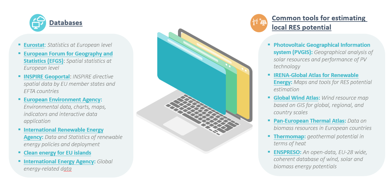
Figure 1 Common tools for estimating local RES potential
Some techno-economical optimization tools offer the capability of acquiring the required data from their databases, such as HOMER Pro, RETScreen Expert, TIMES, etc. (Aryal & Dhakal, 2022; Sifakis et al., 2021). These tools are to be exploited later in the project for the simulations and the technoeconomic analyses of the suggested systems for each case study. The databases’ data will be correlated to the acquires ones to validate their reliability and accuracy (bi-direction correlation).
Besides, the second most preferred option of acquiring regional meteorological and RES potential related data are by getting in touch with the responsible authorities for each specific area, or even from open-source databases (Asakereh et al., 2022). Then, the data series are used as input to specific equations to provide the RES potential outputs (Al-Hinai & Al-Alawi, 1995; Amoatey et al., 2022; Takase et al., 2022). An example of such a database is presented in Figure 10.
During ROBINSON, at the time being, working team has acquired all the required data by cooperating with the involved stakeholders and getting in touch with the corresponding parties. All the required data have been provided by these parties in order to evaluate the current situation of each case study, while estimating each case’s local RES potential.
So far, regarding the available literature on the estimation of the RES potential, and thus the modelling, and simulation of the proposed integrated energy systems, two techniques have been employed to assess the economic potential of RES. As for the first, researchers create the required, technologically feasible solutions, as shown in several previous research works (Koo et al., 2011; Østergaard & Lund, 2011). The economic or socioeconomic costs are employed only as evaluation criteria. Using the second type of methodologies, the economic potential of RES is evaluated by solving an optimization task and identifying the energy mix with the lowest cost (Schmidt et al., 2012).
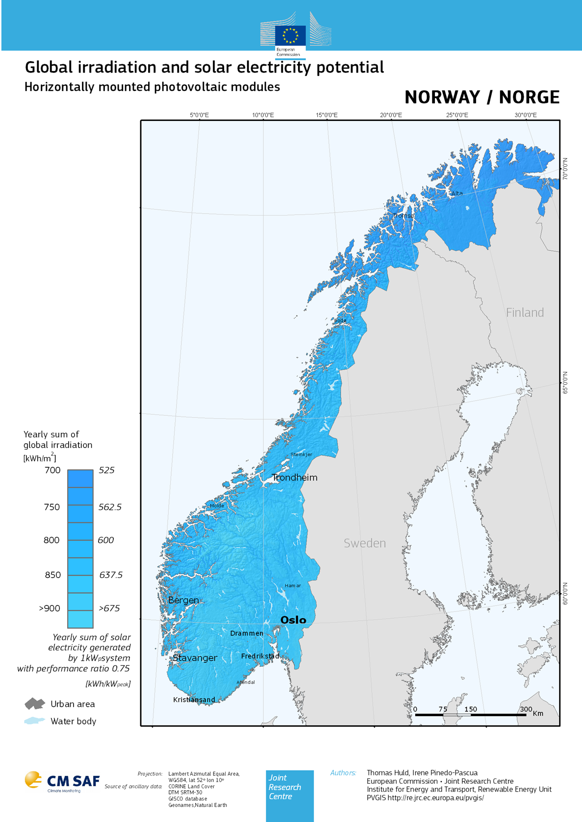
Figure 2 Example of GIS Solar Radiation Mapping (PVGIS, 2022)
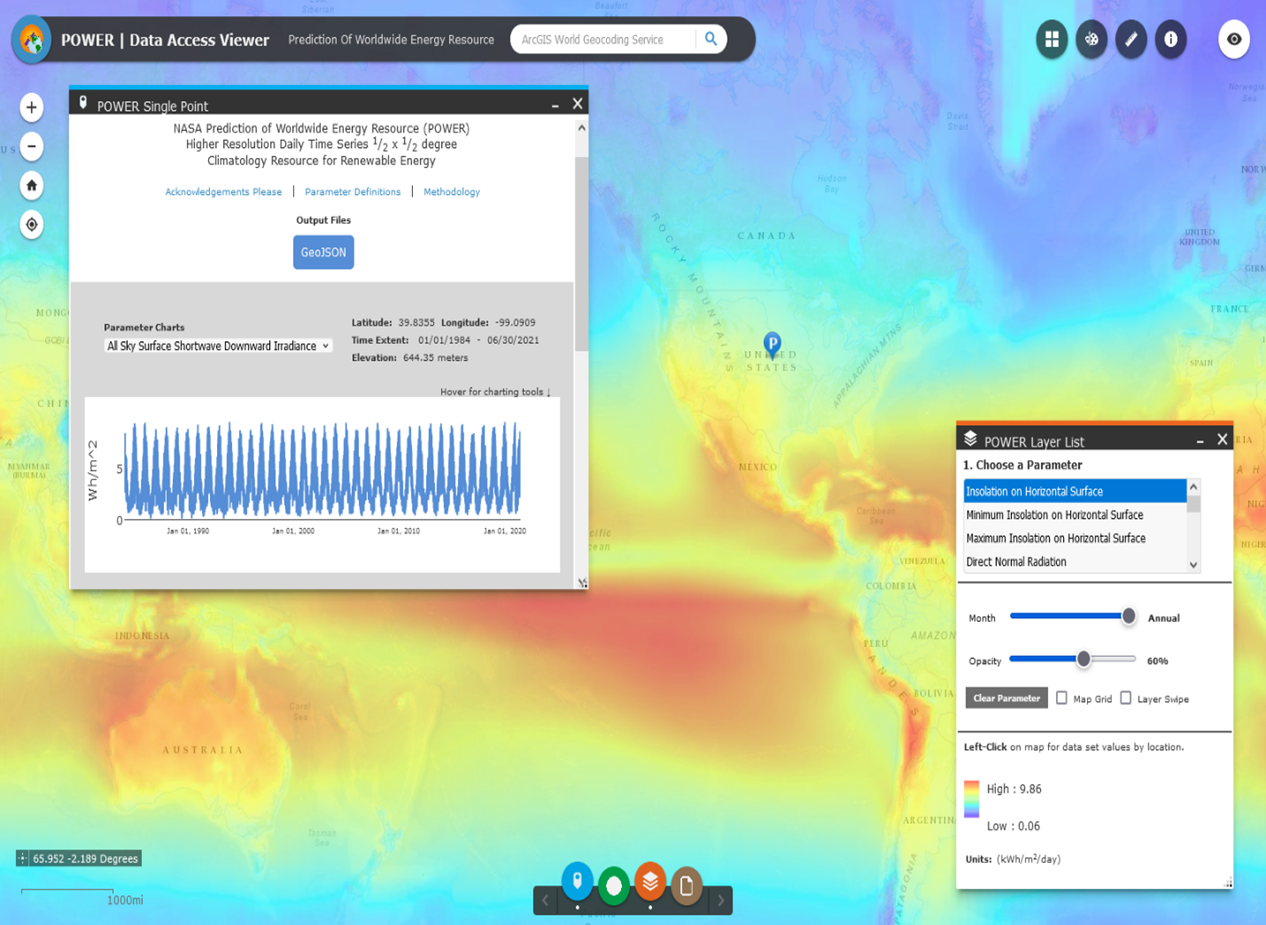
Figure 3 POWER NASA’s database preview